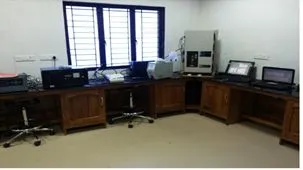
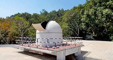

Atmospheric Science Lab
-
Image
-
Image
Atmospheric Science Lab
The Atmospheric Science Laboratory at IIST was set up to provide training and research opportunities for graduate and undergraduate students. The on-campus and off-campus facilities available for graduates and faculty research in atmospheric sciences are state-of-the-art field instrumentation for aerosol-cloud interactions, solar radiation instruments for energy budget studies at the Ponmudi Climate Observatory on the hilltop of the Western Ghats (PCO, 8.76°N, 77.12°E, 1 km, AMSL), Planetary Boundary Layer Laboratory with a wide variety of field instrumentation, and Computer lab in the department for weather data processing and analysis. Students are exposed to numerical modelling. In addition, high-performance computing systems are available for running regional to global models.
IIST- Ponmudi Climate Observatory
All members of the atmospheric sciences faculty are active in research and supervise graduate students' theses and dissertations. The laboratory is having very active doctoral programmes. At present, the faculty and graduate students are actively pursuing the research projects, like; Air-Sea interaction, Boundary Layer Meteorology, Climatology, Aerosol-Cloud-Solar radiation-Climate interaction, Radiative forcing; Satellite Remote Sensing; Data assimilation and Mesoscale modelling; Numerical Modeling of Weather systems; Climate Change.


Atmospheric Science Lab
-
Image
-
Image
The Atmospheric Science Laboratory at IIST was set up to provide training and research opportunities for graduate and undergraduate students. The on-campus and off-campus facilities available for graduates and faculty research in atmospheric sciences are state-of-the-art field instrumentation for aerosol-cloud interactions, solar radiation instruments for energy budget studies at the Ponmudi Climate Observatory on the hilltop of the Western Ghats (PCO, 8.76°N, 77.12°E, 1 km, AMSL), Planetary Boundary Layer Laboratory with a wide variety of field instrumentation, and Computer lab in the department for weather data processing and analysis. Students are exposed to numerical modelling. In addition, high-performance computing systems are available for running regional to global models.
All members of the atmospheric sciences faculty are active in research and supervise graduate students' theses and dissertations. The laboratory is having very active doctoral programmes. At present, the faculty and graduate students are actively pursuing the research projects, like; Air-Sea interaction, Boundary Layer Meteorology, Climatology, Aerosol-Cloud-Solar radiation-Climate interaction, Radiative forcing; Satellite Remote Sensing; Data assimilation and Mesoscale modelling; Numerical Modeling of Weather systems; Climate Change.


Geology Lab
-
Image
-
Image
-
Image
The geology lab in IIST has following facilities
- Good collection of rocks, minerals, fossils, planetary analogue minerals and rocks, and thin sections to examine their physical, chemical and optical properties
- Geological and geomorphological models and raised relief models to demonstrate various geological features and processes
- An advanced trinocular polarizing microscope (Nikon LV100POL) to study the optical properties of rocks and minerals using thin sections
- An advanced stereozoom trinocular microscope for mineral separation from rocks for further mineral chemical, geochronogical and hyperspectral analyses
- Computers in the lab are also equipped with various mineralogical and petrological softwares like IGPET, PETROPLOT, THERMOCAL, TWQ etc.
- Planetary geoscience lab: In collaboration with the Remote Sensing faculty, we make use of the ASD Field Spectro-radiometer to generate the hyper spectral profile of different minerals and rocks for planetary analogue research. The computers in this lab are equipped with softwares such as ENVI with IDL to process and interpret images from Moon and Mars. For example, we use ENVI with CAT (CRISM Analysis Toolkit), which is a collection of ENVI and IDL procedures for reading, displaying, and analyzing CRISM data, produced by the Mars CRISM Science Team.
CRISM Data Analysis Of Mawrth Vallis Region, Mars


Geology Lab
-
Image
-
Image
Good collection of rocks, minerals, fossils, planetary analogue minerals and rocks, and thin sections to examine their physical, chemical and optical properties
Geological and geomorphological models and raised relief models to demonstrate various geological features and processes
An advanced trinocular polarizing microscope (Nikon LV100POL) to study the optical properties of rocks and minerals using thin sections
An advanced stereozoom trinocular microscope for mineral separation from rocks for further mineral chemical, geochronogical and hyperspectral analyses
Computers in the lab are also equipped with various mineralogical and petrological softwares like IGPET, PETROPLOT, THERMOCAL, TWQ etc.
Planetary geoscience lab: In collaboration with the Remote Sensing faculty, we make use of the ASD Field Spectro-radiometer to generate the hyper spectral profile of different minerals and rocks for planetary analogue research. The computers in this lab are equipped with softwares such as ENVI with IDL to process and interpret images from Moon and Mars. For example, we use ENVI with CAT (CRISM Analysis Toolkit), which is a collection of ENVI and IDL procedures for reading, displaying, and analyzing CRISM data, produced by the Mars CRISM Science Team.
The geology lab in IIST has following facilities

IIST Astronomical Observatory
-
Image
At the IIST campus, there is an astronomical observatory with a 14 inch and an 8 inch telescope with imaging and spectroscopic capabilities. The facility is used for undergraduate and postgraduate labs and outreach activities where students get a hands-on experience in carrying out interesting night sky observations.
Apart from this, there is an Astronomy Lab for instrument characterization. This lab is also equipped with desktops and workstations for data reduction and analysis.


IIST Balloon Launch Facility
-
Image
-
Image
Atmospheric research is one of the strongholds of IIST, with a fully owned and dedicated research facility at PCO. The observatory is one of its kind in the country, with provisions for balloon-borne measurements of the vertical profile of ozone along with meteorological parameters from near-surface to stratosphere (35 km). As part of this study, coordinated monthly launches are undertaken at four sites.
Tethered balloons for testing small payloads up to 1 km altitude
Tethered balloons of volume 9.0 m3capable of carrying 1.0-3.0 kg payload weight up to an altitude of about 1 km are also available for conducting various scientific experiments
Balloon launch from IIST-PCO
Tethered balloon


IIST Balloon Launch Facility
-
Image
-
Image
Atmospheric research is one of the strongholds of IIST, with a fully owned and dedicated research facility at PCO. The observatory is one of its kind in the country, with provisions for balloon-borne measurements of the vertical profile of ozone along with meteorological parameters from near-surface to stratosphere (35 km). As part of this study, coordinated monthly launches are undertaken at four sites.
Tethered balloons for testing small payloads up to 1 km altitude
Tethered balloons of volume 9.0 m3capable of carrying 1.0-3.0 kg payload weight up to an altitude of about 1 km are also available for conducting various scientific experiments
Remote Sensing Lab
Remote Sensing lab is equipped with state-of-the-art facilities equipped with hardware and software tools dedicated to processing, analyzing, and interpreting remotely sensed data, such as satellite imagery, aerial photography, ground based and airborne geospatial datasets. The lab has computers with high processing power, large storage capacity, and high-resolution monitors. Students have access to variety of geospatial datasets for the academic and research activities from various platforms such as ground based Instruments like full range spectroradiometer, terrestrial laser scanner, hyperspral imaging system, translational lab measurement unit, laser distometer, LAI meter. High performance Global Navigation Satellite System (GNSS) with Real Time Kinematic (RTK) positioning and UAV imaging system equipped with multispectral and RGB camera are recent additions to the laboratory. Various commercial software packages such as ENVI, ERDAS IMAGINE, TerrSet and ArcGIS installed in the lab, as well as open-source alternatives like QGIS, GRASS GIS, and Python-based libraries such as GDAL, NumPy, and SciPy facilitate the various processing requirements to handle the high resolution geospatial datasets. Remote sensing lab facility serves as a hub for conducting research, education, and applications in the field of geospatial analysis, enabling students to harness the power of remotely sensed data for various purposes including environmental monitoring, urban planning, agriculture, natural resource management, disaster response, etc.